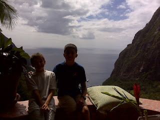
Monday, February 28, 2011

The old, yucky corroded

Thermostat from our big outboard. Our afternoon-long project for today.

Was IT the culprit causing the motor to overheat? We sure hope so! We've already replaced the water pump in Mahon. Fixed the fuel mixture. New plugs. We're out of culprits to blame!

If this doesn't fix it -- well, we have a new anchor.
Sent via BlackBerry by AT&T

Sunday, February 27, 2011

Food fair or PIZZAAAAAAAAA!

Today's food fair was the first food fair that I have ever been to. There was every cuisine that anyone could think of. There was Spanish, mexican, chinese, indian, thai, and everything else. There was a place with grilled pizza, for 10 EC, but when we had some, we discovered that it was sloppily made. Dad and Orion had some chicken kabob, along with the pizza that all of us had, and it was all very cheap.

--By Rigel
Sent via BlackBerry by AT&T

In the distance, Martinique

Uh-oh. Time to learn French. Beyond just being able to say: Do you speak English? Si'l vous plait.
Sent via BlackBerry by AT&T

What? ANOTHER fort?

You said we were DONE with these!
Sent via BlackBerry by AT&T

Friday, February 25, 2011

A Near Collision

A Near Collision

A few days ago, we came the closest to having a collision yet. The strange thing was, we were just sitting there. We were on a mooring, not moving, and were just about to set out on a dinghy trip around the bay. We were having some trouble with the outboard, namely, it flooded and when we tried to fix it by cranking it without the fuel line, we didn't put the fuel connector on properly and it let air in. While we were messing with it, we noticed a small catamaran motoring directly at us. There seemed to be no one at the helm, the only person on deck was taking a picture of a yacht to his stern. Eventually Dad had to shout to get him to notice us, and then he barely got his boat stopped in time to avoid a collision. You really need to be careful in an anchorage, and this was a perfect example of what not to do when entering a harbor.
--Orion Date
Sent via BlackBerry by AT&T

Wednesday, February 23, 2011

One cruise ship

In a small harbor? That we can handle. But FOUR?

Such was the day. Marigot Bay, inner harbor (once used by Horatio Nelson) filled with mooring buoys, no place to anchor, outer harbor afflicted by a big north swell. Castries, infested by cruise ships.

So, off to Rodney Bay it is.
Sent via BlackBerry by AT&T

Check-in/OK message from S/Y Juno SPOT Personal Tracker

S/Y Juno
Latitude:14.08859
Longitude:-60.95972
GPS location Date/Time:02/23/2011 20:26:26 GMT

Message:Juno's latest position:

Click the link below to see where I am located.
http://fms.ws/4IVLz/14.08859/\-60.95972

If the above link does not work, try this link:
http://maps.google.com/maps?f=q&hl=en&geocode=&q=14.08859,-60.95972&ll=14.08859,-60.95972&ie=UTF8&z=12&om=1

S/Y Juno

You have received this message because S/Y Juno has added you to their SPOT contact list.

Every day is an Adventure. Share Yours.
http://www.findmespot.com

Tuesday, February 22, 2011

Video of daddy going under the arch

Sent via BlackBerry by AT&T

The Arch

There is a place in St.Lucia that has this underwater arch that I fun to dive under. This is the first time I went under it. It's a lot easier than it seems. You have to dive down about five or so feet, then turn 90 degrees so that you are now facing under the arch, than go full speed (if you have not chickened out by then) under it and then go rocketing towards the surface. I never got a chance to do this, but you can also go under it while upside down and see the arch above you.

-- By Rigel

Sent via BlackBerry by AT&T

Monday, February 21, 2011

Green flash opportunity

In the rigging for a better view.
Sent via BlackBerry by AT&T

Check-in/OK message from S/Y Juno SPOT Personal Tracker

S/Y Juno
Latitude:13.8569
Longitude:-61.06625
GPS location Date/Time:02/21/2011 18:02:56 GMT

Message:Juno's latest position:

Click the link below to see where I am located.
http://fms.ws/4Hm0o/13.8569/\-61.06625

If the above link does not work, try this link:
http://maps.google.com/maps?f=q&hl=en&geocode=&q=13.8569,-61.06625&ll=13.8569,-61.06625&ie=UTF8&z=12&om=1

S/Y Juno

You have received this message because S/Y Juno has added you to their SPOT contact list.

Every day is an Adventure. Share Yours.
http://www.findmespot.com

Sunday, February 20, 2011

Check-in/OK message from S/Y Juno SPOT Personal Tracker

S/Y Juno
Latitude:13.82567
Longitude:-61.06348
GPS location Date/Time:02/20/2011 13:49:58 GMT

Message:Juno's latest position:

Click the link below to see where I am located.
http://fms.ws/4HMJs/13.82567/\-61.06348

If the above link does not work, try this link:
http://maps.google.com/maps?f=q&hl=en&geocode=&q=13.82567,-61.06348&ll=13.82567,-61.06348&ie=UTF8&z=12&om=1

S/Y Juno

You have received this message because S/Y Juno has added you to their SPOT contact list.

Every day is an Adventure. Share Yours.
http://www.findmespot.com

Saturday, February 19, 2011

From high up between the Pitons

From the "Best Bar in the Caribbean," "Best of the Best Overall" T'cholit bar at the Ladera resort.

Somehow they let our unlaundered selves in. Amazing, we know.
Sent via BlackBerry by AT&T

Friday, February 18, 2011

The Pitons

The Pitons

We are currently moored under the shadow of one of the Pitons, the two huge mountains that rise straight out of the sea here in St. Lucia. The close mountain shoots up out of the water at almost a 70° angle that continues up almost to the peak. The other Piton does not go up at such a steep angle, and is apparently much easier to climb. To climb this one you need rock climbing gear, because the final third goes almost straight up. If we try to climb one, we will either try the easier one, or only go part of the way up the closer one.
--Orion Date
Sent via BlackBerry by AT&T

Wednesday, February 16, 2011

Salty deck

Our boat has gone from salty to non-salty over and over again. When we go on a passage, the deck gets salty. The day before we leave, it rains. Then it gets salty again. This cycle is very annoying. It's like whenever you bring the umbrella, it doesn't rain, but we want it to rain here, so it never does.
--By Rigel
Sent via BlackBerry by AT&T

In the shadow of Petit Piton

After a long, loooong, day to windward.
Sent via BlackBerry by AT&T

Check-in/OK message from S/Y Juno SPOT Personal Tracker

S/Y Juno
Latitude:13.84269
Longitude:-61.06357
GPS location Date/Time:02/16/2011 19:35:45 GMT

Message:Juno's latest position:

Click the link below to see where I am located.
http://fms.ws/4G5vz/13.84269/\-61.06357

If the above link does not work, try this link:
http://maps.google.com/maps?f=q&hl=en&geocode=&q=13.84269,-61.06357&ll=13.84269,-61.06357&ie=UTF8&z=12&om=1

S/Y Juno

You have received this message because S/Y Juno has added you to their SPOT contact list.

Every day is an Adventure. Share Yours.
http://www.findmespot.com

Almost in St. Lucia

37 miles upwind. Those are the Pitons looming ahead.
Sent via BlackBerry by AT&T

Tuesday, February 15, 2011

Pirates of the Caribbean

Pirates of the Caribbean

Today we moved to St. Vincent. The anchorage we are in is an easily recognizable one if you have seen Pirates of the Caribbean. The movie's Port Royale scenes were filmed here, and some of the set is still in place. The loading dock for example. It is not actually connected to shore anymore, but the derrick from which Jack Sparrow swings around on while making his escape is still there, except the metal skeleton is stripped of the wood panels. The cliff with the rocks beneath it is a good snorkeling area, but also devoid of deep water for people to fall or dive into. We also saw the place where the deserted island scenes were shot. It was near the Tobago Cays, right outside the reef, and is called Petite Tobac. You can tell from the angle that the film was shot looking out to sea, avoiding getting the Cays in the shot. It seems that the entire film was shot in St. Vincent and the Grenadines and the movie studio.
--Orion Date
Sent via BlackBerry by AT&T

With our stern tied to a tree

Ashore in Wallilabou, St. Vincent, the setting for much of Pirates of the Caribbean. Yes, including the remnants of the dock Johnny Depp steps onto as his ship sinks beneath him.
Sent via BlackBerry by AT&T

Check-in/OK message from S/Y Juno SPOT Personal Tracker

S/Y Juno
Latitude:13.24668
Longitude:-61.27237
GPS location Date/Time:02/15/2011 18:21:27 GMT

Message:Juno's latest position:

Click the link below to see where I am located.
http://fms.ws/4Fk9Z/13.24668/\-61.27237

If the above link does not work, try this link:
http://maps.google.com/maps?f=q&hl=en&geocode=&q=13.24668,-61.27237&ll=13.24668,-61.27237&ie=UTF8&z=12&om=1

S/Y Juno

You have received this message because S/Y Juno has added you to their SPOT contact list.

Every day is an Adventure. Share Yours.
http://www.findmespot.com

Monday, February 14, 2011

Our last roti

From Sweety Bird's Cafe. Or what's left of it.

Leaving Bequia tomorrow heading northward.
Sent via BlackBerry by AT&T

Sunday, February 13, 2011

Slap

Mosquitoes are annoying. This is a well known fact to many people. The funny thing is that no matter how much you are with them, the more annoying they get. You would expect it to be the other way around. Once we got so irritated, we got the vacuum cleaner and started to suck them up. After much obsession, we sprayed a bit of raid down the tube. In some places, the mosquitoes are so unbearable, they get bug zappers. There are many ways to keep mosquitoes away, but they are still annoying.
--By Rigel
Sent via BlackBerry by AT&T

Saturday, February 12, 2011

Rain

Rain

It really gets on my nerves after a while. All winter in Sibari, I had to put up with it raining almost every day. I've just about had it. I admit that we have had no rain for a couple days, but the weather is sure making up for its error. All @%#$ing day it's been raining, except for a brief respite in the morning, when we couldn't go out because we were doing schoolwork. It did this in the Tobago Cays too, but at least we could see the squalls coming over the water. Now there's a hill in the way that completely blocks our view of oncoming weather. Ever since we got to Bequia, it has rained almost every day, except for a couple days I have mentioned before. Whenever we go anywhere, we either have to wait for a weather window, or risk getting soaked. We also have to close all of the hatches whenever it starts raining, which makes it incredibly hot inside. I am pretty annoyed about the current bout, I was looking forward to going to the beach, but it shows no signs of abating, so I fear I will be disappointed.
--Orion Date
Sent via BlackBerry by AT&T

Tuesday, February 8, 2011

See?

It'll fit, and it'll LIKE it.
Sent via BlackBerry by AT&T

The new cookie sheet is too big to fit in the oven?

We've got both a Dremel tool AND a hammer! We'll make it fit by Jove!
Sent via BlackBerry by AT&T

Sunday, February 6, 2011

That old tire

Today we found a tire on the bottom. It was an old tire, with some coral on it, a few fish swimming around it, probably from a large boat for use as a fender. And with a closer look at it, one would find a spiny thing coming out from underneath. Take a closer look, and find that the spiny thing was moving. Take an even closer look, and one would realize that the spiny thing was an antenna of a lobster, and would try to grab it without success. After several tries, one would take the whole tire off the bottom, to discover two lobsters, a grouper, more coral, half a school of minnows, a whole lot of sand, and several sea urchins. Both lobsters are too small to take, and one would drop the tire onto the bottom. We did all of this, but more. One of the lobsters crawled out and ran away. When we picked it up, all the sea life came out, spare the urchins and the one remaining lobster. After much struggle, the lobster came out. It is time now to explain how a lobster swims. These are spiny lobsters, and have no claws. The lobster puts its legs and it's antennae against its body, and flaps its tail and shoots off like a torpedo. This looks extremely silly, though they move incredibly fast. The lobster did this, angling it's self at the bottom, on the other side of the boat. We went to the other side, caught it, saw that it was to small and set it free to do its little lobster-swim to the bottom again, free.


--By Rigel
Sent via BlackBerry by AT&T
Our corner of Admiralty Bay

From Fort Hamilton. Named after Alexander Hamilton. Who was born on Nevis. Which, although in the Caribbean, is nowhere near Bequia.
Sent via BlackBerry by AT&T

Saturday, February 5, 2011

Enjoying the luxury

Of a forecabin with freshly laundered linens. No, it doesn't happen often.
Sent via BlackBerry by AT&T

Wow!

This waterproofing stuff really works! Too bad the previous owner only left enough aboard in a small glass, former jam jar from Honduras to do half the bimini top.
Guess it's time to find a chandlery. . .
Sent via BlackBerry by AT&T

Thursday, February 3, 2011

After a long, hard slog to windward

Back in our old corner of Bequia's Admiralty Bay.
Sent via BlackBerry by AT&T

Check-in/OK message from S/Y Juno SPOT Personal Tracker

S/Y Juno
Latitude:13.01077
Longitude:-61.24454
GPS location Date/Time:02/03/2011 20:56:27 GMT

Message:Juno's latest position:

Click the link below to see where I am located.
http://fms.ws/4Bkoh/13.01077/\-61.24454

If the above link does not work, try this link:
http://maps.google.com/maps?f=q&hl=en&geocode=&q=13.01077,-61.24454&ll=13.01077,-61.24454&ie=UTF8&z=12&om=1

S/Y Juno

You have received this message because S/Y Juno has added you to their SPOT contact list.

Every day is an Adventure. Share Yours.
http://www.findmespot.com

Wednesday, February 2, 2011

Guess who was beneath our boat

When we went to check our anchor?

Yup, a great big queen conch. And so, it's conch with garlic lobster cream sauce over linguini for dinner.

Better than beans with rice, again.
Sent via BlackBerry by AT&T

Check-in/OK message from S/Y Juno SPOT Personal Tracker

S/Y Juno
Latitude:12.71144
Longitude:-61.32813
GPS location Date/Time:02/02/2011 21:11:48 GMT

Message:Juno's latest position:

Click the link below to see where I am located.
http://fms.ws/4BRyq/12.71144/\-61.32813

If the above link does not work, try this link:
http://maps.google.com/maps?f=q&hl=en&geocode=&q=12.71144,-61.32813&ll=12.71144,-61.32813&ie=UTF8&z=12&om=1

S/Y Juno

You have received this message because S/Y Juno has added you to their SPOT contact list.

Every day is an Adventure. Share Yours.
http://www.findmespot.com

Tuesday, February 1, 2011

Windward Bay, Mayreau

Where we were anchored this morning, and the Tobago Cays, where we were for the previous week.

Now we need lettuce. And flour for bread. So here we are, climbing hills.
Sent via BlackBerry by AT&T

What? The grocery store is at the TOP of a hill?

Why!?!
Sent via BlackBerry by AT&T